- National Park / Kendari
- -3.9430951, 122.5417665
- Open in Google Maps

Murhum Forest Park (Tahura Murhum), located in Nipa-Nipa Highlands in Mandonga sub-district, Kendari and Soropia sub-district, Kendari district, Southeast Sulawesi, is one of 16 forest areas in Southeast Sulawesi used for natural conservation. This forest park has an area of 8,146 hectare at an elevation of 25 to 500 meters above the sea level. The topography is mostly sloping, hilly and mountainous with 15-40 slope degrees. The land is mostly made of yellow red podzolik soil.
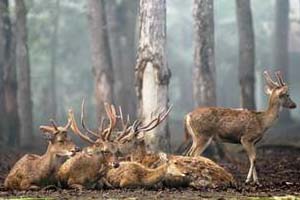
Tahura Murhum is a lowland forest ecosystem with low mountains with lots of flora and fauna. The flora consists of shrubs, bushes, bolo-bolo, white bolo-bolo, ironwood, pandanus mats, puta wood, palm and rattan. The fauna consists of amongst others anoa, deer, kuskus, sulawesian fox, rengkong, sulawesian musk, sea eagle, and many kinds of butterfly.
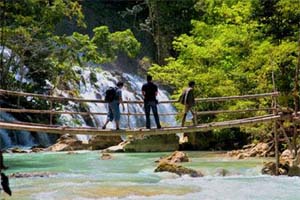
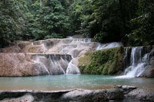
Inside the forest, managed by KSDA Soropia, you will be able to see a 15 meters high waterfall, where you can join the others and take a swim here. After that don't forget to catch some history by visiting the bunker build by the Japanese army in the Second World War, with a cannon still on top of it.
Transport options Murhum Forest Park
From Kendari's Wolter Monginsidi Airport, you can go to Kamaraya village, Benu-Benua, Tipulu, Sodohoa, Jati Mount and Mangga Dua by public transportation or private vehicle. As you arrive in Mangga directly go to Tahura Murhum on foot through a 7 miles long path that will take approximately 2 hours.


